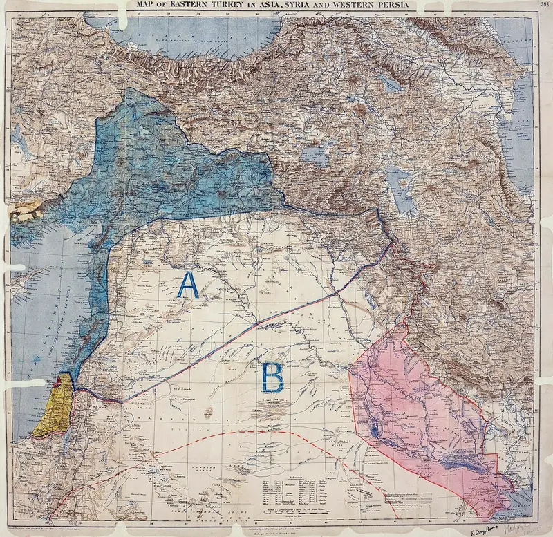
 Royal Geographical Society (Map), Mark Sykes & François Georges-Picot (Annotations), Public domain, source
A secret Anglo-French deal dividing the Ottoman Arab provinces into spheres of influence. It became the rough template for the borders of Syria, Lebanon, Iraq and Jordan.
W Read on Wikipedia ↗